To provide you with the best experience, cookies are used on this site. Find out more here.

To provide you with the best experience, cookies are used on this site. Find out more here.


Spiterstulen lies 1100 m.a.s.l. at the forest border in the beautiful valley of Visdalen in Lom municipality in Jotunheimen. This is a popular starting point for trips to Galdhøpiggen.
The trip from Spiterstulen to Galdhøpiggen can be done both with and without a guide, and there are several route options. The most common route is not crossing the glacier, and it is easy to follow the well marked path.
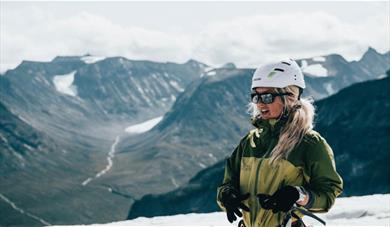
If you want to go to Galdhøpiggen by crossing the glacier, this is a longer, but much more exciting route to the summit of Galdhøpiggen, 2469 meters above sea level.
This round trip is 13 km. long, with an increase of 1350 vertical meters. The trip usually takes between 7 - 9 hours.
The route includes a spectacular glacier crossing and steep, but easy scrambling up the south face of Galdhøpiggen. We follow the normal route down to Spiterstulen. It is a demanding trip suited for fit youths and adults.
Facts:
- 1350 meters of altitude gain
- 12 kilometers in total
- 9 hours in total
- Necessary glacier gear provided (crampons, harness, helmet and rope)
From Highway 55 in Bøverdalen is 18 km from the private toll road from Røisheim to Spiterstulen. The road has been approved for all types of vehicles except caravans, buses and other vehicles over 6 meters. Please note that the road is closed by a barrier 5 kilometeres from the Mountain Lodge, and is open when the Mountain Lodge is open!
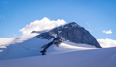 Galdhøpiggen 2469 m.a.s.l. - the highest mountain in Norway, LomGaldhøpiggen is the highest mountain in Norway, 2.469 m.a.s.l.
 Spiterstulen | Mountain Lodge, LomSituated at 1100 meters above sea level, Spiterstulen Mountain Lodge is the perfect starting point for hiking in the mountains of Jotunheimen.
 Spiterstulen glacier and mountain guides | Guiding activities in Jotunheimen, LomThe guiding and activity providing company Spiterstulen Glacier and Mountain guides is based on long guiding traditions in the areas around the tourist hut Spiterstulen. It started with guided hikes to Galdhøpiggen, the highest mountain in Norway, already in the1850s.
The area around Spiterstulen…
Spiterstulen glacier and mountain guides | Guiding activities in Jotunheimen, LomThe guiding and activity providing company Spiterstulen Glacier and Mountain guides is based on long guiding traditions in the areas around the tourist hut Spiterstulen. It started with guided hikes to Galdhøpiggen, the highest mountain in Norway, already in the1850s.
The area around Spiterstulen…
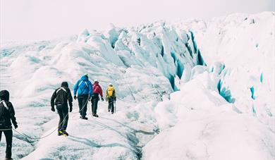 Glacier Hike at the "Fairytale Ice" | Spiterstulen bre- og fjellføring, LomFairytale Ice – Norway's most beautiful glacier in Jotunheimen National Park.


© Visit Jotunheimen. All Rights Reserved