


Scenic Route Sognefjellet (Road 55)
Type:National Tourist Route
Sognefjellsvegen, 2686, Lom
Tel: 175
To provide you with the best experience, cookies are used on this site. Find out more here.

Tel: 175


The Norwegian Scenic Route Sognefjellet is northern Europe’s highest mountain pass, and runs from Lom to Gaupne, a total distance of 108 km (Road 55).
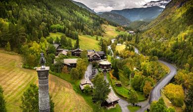
From the verdant meadows and the lush cultural landscape of Bøverdalen you can catch a glimpse of towering mountains in the far distance, as the road slowly ascends through the valley. It makes its way up to the summit at 1,434 metres.
Description of the road:
From the starting point in Lom, your expectations rise even before you drive out of the small village. Not every tourist route provides such a natural dramatic setting with a profusion of powerful impressions. Along the road you will be tempted to stop at the viewing points to soak in the beauty of the natural surroundings.
At the Mefjellet stop you will find Knut Wold’s stone sculpture which allows us to view the mountain landscape from a different perspective. Continuing down towards the Sognefjord the mountain region appears untamed. Where the Hurrungane massif towers up to the heavens the mountains suddenly open up and the landscape changes once again.
Towards Gaupne, the final point on this stretch, the road descends to skirt the beautiful Sognefjord whose clear waters change colour from green to blue in tune with the light and the weather. What should you do when you arrive? Relax and let your impressions sink in. Some people turn and drive the same way back, and are surprised to see how different everything is. Although everything is the same, it’s as if you see the surroundings anew.
Biking at Sognefjellet:
Bringing your bike is a great experince at Sognefjellet. Starting from Fortun, the Sognefjellet ascent is 19.96 km long. Over this distance, you climb 1375 heightmeters.
History:
The road over Sognefjellet was an important transport artery linking the coast and inland areas. Trading led to the transport of salt and fish eastwards while butter, pitch and leather were transported west. Travelling across the mountain in the old days was not without its perils – vagabonds robbed travellers and merchants.
The forces of nature can also be difficult for us humans to defy. In the winter the weather is so severe and the snow masses so enormous that it is impossible to keep the road open. If you make the trip just after the road opens in springtime, the almost ten-metre high banks of snow at the side of the road will be visible proof of the power relationship in the mountains in winter. Nature is the deciding force and this is a reminder that it is we who must adapt.
Winter closed:
The mountain road from Liasanden to Turtagrø is closed during winter. Previous closures are between 17 November and 17 December. Previous openings are between 12 April and 1 May. NOTE! After opening, the road may be closed for a period at night and in bad weather.
Source: nasjonaleturistveger.no
Traffic and road information - Telephone +47 815 48 991. Traffic alerts in map >> GPS: Lom 61.831129, 8.554187 Gaupne 61.395127, 7.303172
* The mountain road from Liasanden to Turtagrø is normally closed in November and reopens in May.
 Jotunheimen Fjellstue | Mountain lodge, LomJotunheimen Mountain Lodge is situated along the National Scenic Roard, Sognefjellsvegen (Fv 55) with beautiful view of the mountain landscape.
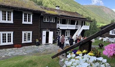
 Elveseter | Hotel, LomThe old family farm Elveseter has received guests since the 1870’s. Throughout the last century the farm has been transformed into one of the most unique hotels in Norway.
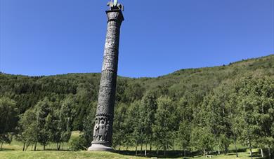 The Saga Column, Lom"Sagasøyla", until 1992 called "Eidsvollsmonumentet", is a 34 meter high column with sculpture and reliefs - designed by the sculptor Wilhelm Rasmussen in the 1920s.
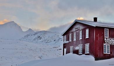 Krossbu | Mountain Logde, LomKrossbu Mountain Lodge is a private tourist lodge with majestic surroundings on route 55 - the Sognefjellet road - Norway's highest mountain pass.
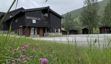 Bøverdalen Vandrerhjem | Hostel and Cabins, LomBøverdalen hostel is located in Bøverdalen, next to Sognefjellsvegen – and is an excellent starting point for hiking, summer skiing and ski touring in Jotunheimen.
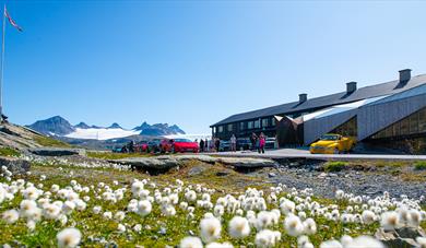 Sognefjellshytta | Mountain Lodge, LomSognefjellshytta is situated 1,400 meters above sea level at the NorwegianScenic Route Sognefjellet, northern Europe’s highest mountain pass.
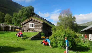 Strind Gard | Farm Stay, LomStrind Farm has cabins/rooms, including some offering high standard, at reasonable prices in an intimate and romantic farm environment.
 Teigen Gard | Farm Stay, LomTeigen gard (farm), with active sheep farming, lies 3 kms west of the centre of Lom, on route 55 towards Sognefjellet.
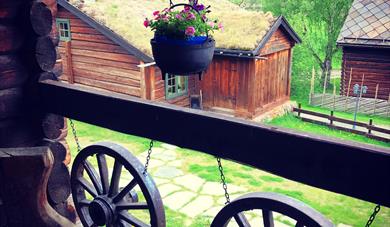 Galde Uppigard | Farm Stay, LomUppigard Galde farm is situated 550 masl. in the beautiful and astonishing mountain valley of Bøverdalen i Jotunheimen in Norway.
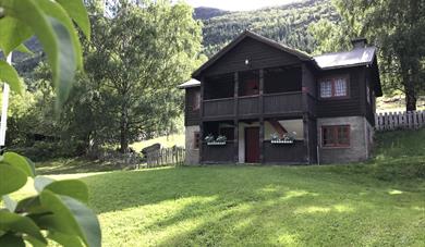
 Røisheim | Hotel, LomRøisheim Hotel, in the beautiful Bøverdalen Valley, consists of 14 preserved buildings, mostly from the eighteenth century. All the buildings have been faithfully restored to modern standards of comfort. It is regarded as one of Norway’s most distinctive hotels, and has a well-deserved reputation…
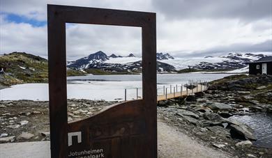
 Breheimen | National Park, SkjåkBreheimen National Park - from perennial ice to lush valleys with transhumance farms
Breheimen means "the home of the glaciers". The National Park - established in 2009 - is located in the municipalities of Skjåk and Lom in Oppland county and in Luster in Sogn og Fjordane county, Norway. The park…
Breheimen | National Park, SkjåkBreheimen National Park - from perennial ice to lush valleys with transhumance farms
Breheimen means "the home of the glaciers". The National Park - established in 2009 - is located in the municipalities of Skjåk and Lom in Oppland county and in Luster in Sogn og Fjordane county, Norway. The park…
 Andberg Gard | Farm Stay, LomAndberg farm is a charming small farm just outside the centre of Lom. Here you can stay in either a old Storehouse or Fire House, both restored.
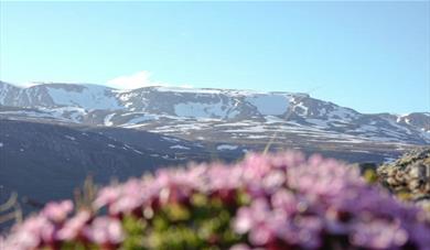
 Viewpoint | Sognefjellet, LomAt Sognefjellshytta there is established a viewpoint where you can take a stop, stretch your legs, go for a small walk and get an impression of the Jotunheimen National Park.
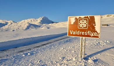 Scenic Route Valdresflye (FV 51), VågåNorwegian Scenic Route Valdresflye runs from Garli to Hindsæter, with a detour to Gjende, a total distance of 49 km (Road 51). This is an excellent alternative if you are heading north, or it can be included in a wide variety of round trips.
Parts of the route are closed during the winter between…
Scenic Route Valdresflye (FV 51), VågåNorwegian Scenic Route Valdresflye runs from Garli to Hindsæter, with a detour to Gjende, a total distance of 49 km (Road 51). This is an excellent alternative if you are heading north, or it can be included in a wide variety of round trips.
Parts of the route are closed during the winter between…
 Liasanden rest area along Sognefjellet, LomTake a rest the atmospheric and bike friendly Liasanden rest area on your way over the Norwegian Scenic Route Sognefjellet.


© Visit Jotunheimen. All Rights Reserved
